Poster at Kuuku yau handover

Kuuku Ya’u handover

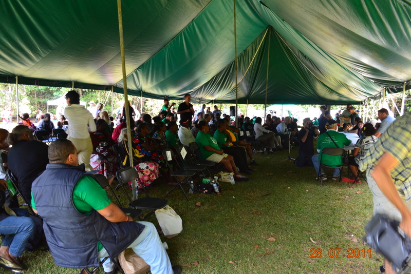
July 28th 2011 was the culmination of many years of struggle by the Kuuku Ya’a people to reclaim their traditional lands.
handover
handover

They met with government officials for the “signing of the indigenous management land use agreement for Kutini-Payarnu(Iron Range), Piper Islands, Wuthara Island, Mitirinchi Island and Ma’alpiko Island national parks (CYPAL)”, and the “delivery of deeds of grant to the Northern Kuuku Ya’u Kanthanampu Aboriginal Corporation RNTBC Land Trust”.
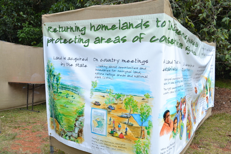
Poster at Kuuku yau handover

There were speeches from many people including David Thompson, the priest, linguist and anthropologist who gave thanks to the creator and acknowledged “the Traditional Owners, the Kuuku Ya’u People, including both Kungkay and Kanthanampu groups, Honorable Ministers Vicki Darling and Rachel Nolan, the Member for Cook, Jason O’Brien, mayor and councillors of Cook Shire Council and Lockhart River Aboriginal Shire Council, and other distinguished guests”.
He spoke movingly about the history and ended with: “The challenge today is to find a right balance between the past, the present and the future. Today’s handover is an opportunity for today’s generation to strengthen their ties with their land, their families and their ancestors, while at the same time looking to the future to make the best choices for life in the modern world.”

Jasmine and Greta
Jasmine and Greta

The elders were eloquent with their words and the depth of feeling was indicated when two of the younger traditional owners (Jasmine and Greta Accoom) impressed the audience with their moving and emotional words.

Environment Minister, Vicky Darling stated: “Iron Range National Park will expand by more than 7,700 hectares when the Bligh Government today transfers five national parks and adjacent areas on the Cape York Peninsula to the Traditional Aboriginal Owners.” She added that the Iron Range National Park will be “renamed the Kutini–Payamu (Iron Range) National Park – Kutini means cassowary and Payamu means rainbow serpent in the language of the Kuuku Ya’u people, the Aboriginal Traditional Owners of this park.”
She added “I would like to thank the Kuuku Ya’u people and their advisers, the Balkanu Cape York Development Corporation and the Cape York Land Council, for their time in working through the details of this complex set of agreements.”

Spaceport at Temple Bay

On 3rd Feb 1988, the Cape York Space Agency (CYSA) was awarded the contract for a feasibility study for a space port on Cape York. This was under the Joh Bjelke-Petersen government.
Rumours abounded but it appeared that Temple Bay was the ideal spot.
Aboriginal people, the Wuthathi and Kuuku Ya’u were vocally against the proposal. Many other groups and people condemned the idea, including the Wildlife Preservation Society of Queensland, and the famous science fiction author Arthur C. Clarke.
This saga, which was opposed (but rarely reported) from the beginning by the Kuuku Ya’u and Wuthathi people, had begun in about 1986 when the then premier Joh Bjelke-Petersen claimed to have thought of the idea.
For the next decade or so the idea of the space port floated here and there, with grand plans and sometimes grander costings.

The Koori Mail’s article (CAPE YORK ABORIGINES SLAM SPACE PORT PROPOSAL ‘The area is a fighting ground where Aboriginal people died and where their spirits remain’.) was about the only media outlet to give a fair aboriginal viewpoint.
The article  states: “At a land rights meeting held recently at Lockhart River attended by representatives from all Cape York Aboriginal and some Torres Strait island communities, representatives voted to support the Wuthathi and Kukuy’au (sic) tribes stance of no space port in Cape York Peninsula.
Aboriginal representatives say the main reasons for this stance are that it infringes on traditional lands, it is not a viable enterprise that will benefit the rightful owner, it is merely an excuse to open up Cape York to massive tourist and unaboriginal development, and that the development of such a project will have a catastrophic result on the environment.”

The space port saga eventually ended, but probably more for financial reasons than aboriginal rights or environmental reasons.

Chapter 4 of Michael Meadows’ book “Voices in the Wilderness – Images of Aboriginal People in the Australian Media” gives a very good account of the bias in the media of this issue.

Many of the hippies at Chili beach and residents at Portland Roads were against the idea too.

Cedar Bay Hippy Raid

In one of the more infamous episodes in Queensland, during the reign of Joh Bjelke-Petersen, police in para-military gear raided a hippie commune at Cedar Bay.

This was on August 29th 1976, and the peaceful village was razed to the ground.

Many of the first wave of hippies to arrive at Chili Beach were refugees from Cedar Bay.  According to most locals they were nice peaceful people “minded their own business”.

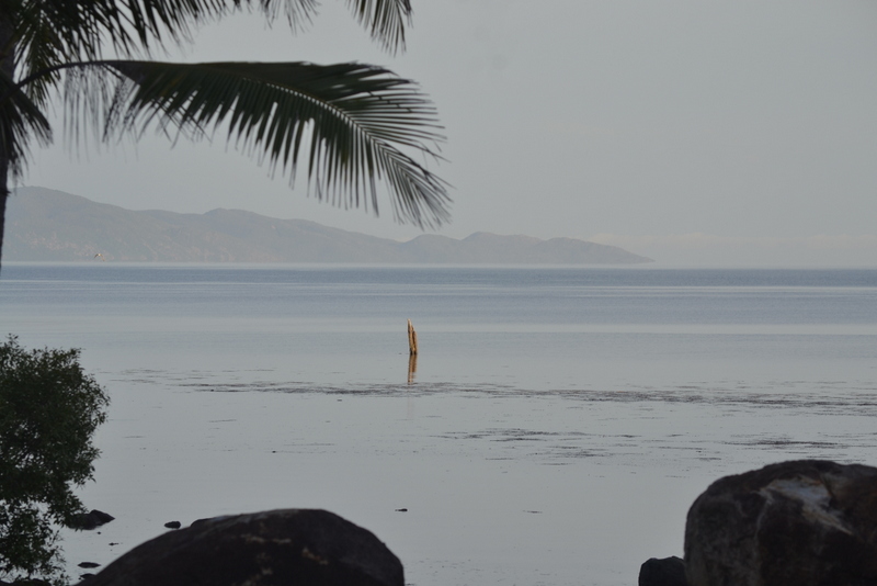
Jetty pylon at low tide

Jetty blown up

The jetty was demolished in 1976 (SC – to check exact date).

And for years after the demolition one pylon was visible at low-ish tides, but mid 2012 it disappeared, presumably rotted away. There were stories of great fishing there at night.
And another time, one dark night “I heard this really loud bang, then loud drunken swearing – X, who was drunk had managed to hit that pylon all the way out there by itself – God knows how”.

It was a great reference point “The jetty went right out to there”.

(SC – more to come)

Lockhart moved from “Old Site” to where it is now

The original Lockhart mission “Old Site” was moved to it’s current site in 1969.

Lucy H remembers moving from “Old Site”:

“It was 1969 that we moved over, as I remember my family and I were the last ones to move from Lockhart mission. My husband, Joseph, his grandmother Nellie Siev and grandfather Harry Siev, Rosemary Siev (adopted) and Novina my first child.”

She remembers that some people did not want to move.

“My husband was working at the store, so they had to send some of the people over. The old people were left there for the next trip to come. Some, just didn’t want to move. So we had to stay there ’til, you know, the food line because of the store to feed the old people – Lorraine, Grace, Ina”

[SC – more to come] (not sure of month of move)

Mary Lockhart

Lucy’s earliest memories of Portland Roads

Lucy still lives in Lockhart and her father was the captain of the lugger (Mary Lockhart) which used to deliver cargo to Portland Roads among other places. We asked her about her earliest memories of Portland Roads.

“It would be about 1956 or 1957 I would say. We were living at Portland roads, sorry, Old Lockhart mission. My father was captain of the Mary Lockhart – the boat – the cargo boat that comes here.
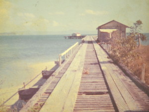
He was the skipper of the boat and we would catch a trip to Portland roads to get cargo and then they take it back (there used to be a big jetty and we used to run along the jetty every time)”

Mary Lockhart
Mary Lockhart
Jetty

Jetty Built

The jetty at Portland Roads was built in about 1938/39 to service the gold mining activities at Batavia Goldfield (later called Wenlock) and the Iron Range area. It was 810 feet long to reach the deep water. A tramline ran out to the wharf (60 ft x 30 ft) at the end of the jetty. There was a shed located on the wharf.

“the jetty is now complete” announced The Cairns Post, on Friday 25 November 1938. It seems that this was according to a report of the Queensland Department of Harbours and Marine for the year ended June 30, 1938, so presumably the jetty was actually completed before the end of the financial year 1938.

On 27 September 1938 it was reported that the jetty was used for the first time by the steamer Wandana.

In August 1937, the Mines Department requested a jetty be designed and built to service the Batavia (later called the Wenlock) Goldfields and the Iron Range area.

Jetty plans were submitted to the Mines Department on October 29, 1937 with an estimated costing of £5778. The Minister approved the project with a maximum budget of £6000; tenders were called for on November 15th and accepted on December 15th.

It was reported on 24 Jan 1938 that “Work is proceeding on the construction of a jetty at Portland Roads, the Peninsular port for the Bartavia and Iron Range goldfields”.

The dimensions of the jetty were as follows, according to the Cairns Post on Fri 25th November 1938: “The jetty is 813 feet 9 inches over all length, with a T-head 60ft by 30ft, and a stem 10ft wide, with a 20ft by 15ft shed on the T-head, and a 3ft 6in tramway along the jetty. There is 15ft 6in at low water at the jetty berth.
Regulations for the control of the jetty have been gazetted.”
(CITE: Article identifier: http://nla.gov.au/nla.news-article42152478)

Jetty
Jetty


Aboriginal Protection Restriction of the Sale of Opium Act 1897

“The Queensland Parliament passed the first Act exclusively devoted to regulating every element of Aboriginal lives, the Aboriginal Protection and Restriction of the Sale of Opium Act in 1897.” Aboriginal Protection Restriction of the Sale of Opium Act 1897

The government of the day used this act to move Lockhart people from “Old Site” to Lockhart in 1969.
Lucy Hobson remembers:
“It was 1969 that we moved over, as I remember I was the last one to move from Lockhart mission.
My husband was cooking up at the store, so we had to send all the people, they were all old people left there for the next trip to come. Some, just didn’t want to move. So we had to stay there ’til, you know, the food line because of the store.”

naming of portland roads

Cook’s journal – Weymouth Bay Naming

Cook’s log states that he named Cape Weymouth and Weymouth Bay presumably after Viscount Weymouth but did not mention Portland Roads.

“On the Mainland within us was a pretty high promontory, which I called Cape Weymouth (Latitude 12 degrees 42 minutes South, Longitude 217 degrees 15 minutes); and on the North-West side of this Cape is a Bay, which I called Weymouth Bay.” (Cook’s Journal August 16th 1770)

Weymouth is next to Portland in England; Viscount Weymouth and Duchess of Portland were of the same family

The natural Portland anchorage is known as the Portland Roads.

naming of portland roads
naming of portland roads (opens as a pdf)

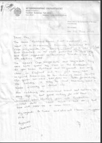
Geoff Pope supplied a document from the British Hydrographic Department that states that the first mention of Portland Roads is in the sailing directions of Lieut Hemmings 1896 from Cape Weymouth to Torres Strait.

Cook named the Isle of Portland in NZ after the Isle of Portland in UK because it looked similar

The Duchess of Portland was a great collector of items that Joseph Banks collected on his journeys.